MOROGORO
Urban and peri-urban agriculture in Morogoro Municipality
The history of Morogoro Municipality starts during the Slave trade when the Arabs used it as a stopover during the Caravan route from the hinterland to the coast. It is located in Morogoro Region covering 531 out of 73,039 Square Kilometers of Morogoro Region. The municipality is located about 200 Kilometers from Dar es Salaam and considered a coastal area. In 2019, it was projected to have 396,481 people. The municipality is among the fastest-growing urban centers in Tanzania (Image 1).
Uluguru Mountains which lie in the south-eastern part and the Mindu mountains in the western part are the major physical features of the Morogoro landscape. Waluguru is the dominant ethnic group in the municipality, however, ethnicity is currently mixed. As a result of administrative decrees, some of the rural people have been included in the urban population. Moreover, migration to the municipality has been reported to be among many factors that cause an increase in population. Growing urban poverty is one of the major concerns in the Municipality, whereby more than 60 percent of people live in an unplanned settlement with limited access to basic social services. Furthermore, polluted water resources and poor solid waste management are just some of the environmental challenges.
The slopes of Mount Uluguru are reported to contain the major producers and suppliers of horticultural crops in Tanzania. Thus, Urban and Peri-urban Agriculture (UPA), including the cultivation of crops, livestock keeping, and floriculture are common UPA practices in the municipality. It is estimated that 32 percent of the municipality's population is engaged in UPA. Cultivation of horticulture crops such as leafy vegetables, tomatoes, sweet pepper and food crops such as maize, paddy, and livestock keeping are common in both intra and peri-urban areas. Horticultural crops and livestock keeping contribute significantly to food availability and income to the people of Morogoro compared to food crops. (Photo 1, 2 and 3)
Wetlands and rivers (Kikundi and Morogoro) facilitate the cultivation of such crops. The Strategic Plan of 'Morogoro Municipal Council (2016/2017-2020/2021)' advocates the advancement of the agriculture sector to increase revenue. The plan indicates that upgrading agricultural activities will be achieved through training of farmers for post-harvest loss of crops (particularly maize, tomato, mango and green vegetables), increasing livestock production, adoption of technologies such as using greenhouses, improved extension service delivery, and improvement of agriculture infrastructure such as crop markets for collection of revenues among others. These strategies are good opportunities to recognise and support UPA practices. However, the implementation has fallen short, because an indication of land zoning for open spaces farmers is still lacking. It is noted that land for agricultural activities is under pressure because of the increasing population, and the expansion of built-up areas. More so, the '1999 Morogoro By-laws on Urban Livestock Keeping' has some restrictions which could impede livestock production. This shows that UPA should be integrated into urban development planning, not only as a source of revenue collection but also to accommodate and promote its practices.
.


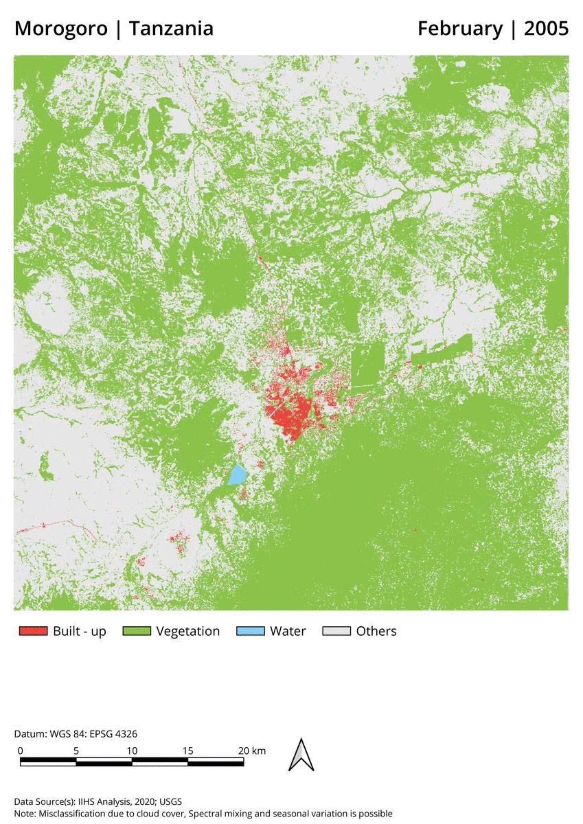
Figure 1: The location of Morogoro Municipality.
Photo 1: Banana cultivation
Photo 2: Dairy cattle in peri-urban areas
Photo 3: Sunflower cultivation
Figure 2; A visual comparison of Morogoro's expanding built-up areas, between 2005 and 2019. (Source: Teja Malladi et al. Geospatial Lab, Indian Institute for Human Settlements).